Marble/Runners/LoadingOSM
| Tutorial Series | Marble C++ Tutorial |
| Previous | Tutorial 4 - Changing basic map properties |
| What's Next | Tutorial 6 - Displaying places the proper way(via GeoDataDocument) |
| Further Reading | n/a |
Exporting OSM
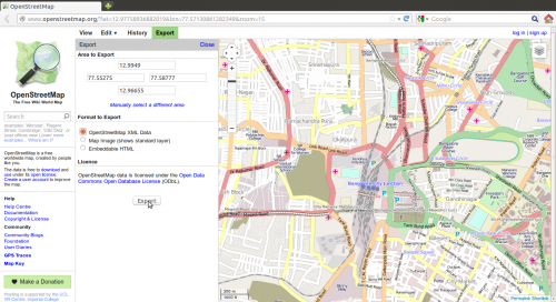
Osm files can be used for creating small street maps or can be scaled to store streets worldwide. OSM files can be exported from OpenStreetMaps by clicking the export button as shown below.

Loading OSM files into a Marble Widget
Marble uses so-called runners to calculate routes, do reverse geocoding, parse files and search for placemarks (cities, addresses, points of interest, ...). This tutorial shows how to open a .osm file and display it into the Marble Widget.
#include <QtCore/QDebug>
#include <QtCore/QFileInfo>
#include <QtGui/QApplication>

#include <marble/MarbleWidget.h>
#include <marble/MarbleModel.h>

using namespace Marble;

int main(int argc, char** argv)
{
    QApplication app(argc,argv);

    QFileInfo inputFile( app.arguments().last() );
    if ( app.arguments().size() < 2 || !inputFile.exists() ) {
        qWarning() << "Usage: " << app.arguments().first() << "file.osm";
        return 1;
    }

    MarbleWidget *mapWidget = new MarbleWidget();
    mapWidget->setMapThemeId("earth/openstreetmap/openstreetmap.dgml");

    mapWidget->centerOn( GeoDataCoordinates( 77.5674, 12.9782, 0, GeoDataCoordinates::Degree ) );
    mapWidget->zoomView( 3000 );

    mapWidget->model()->addGeoDataFile( inputFile.absoluteFilePath() );

    mapWidget->show();

    return app.exec();
}
Copy and paste the code above into a text editor. Then save it as my_marble.cpp and compile it by entering the following command on the command line:
g++ -I /usr/include/qt4/ -o my_marble my_marble.cpp -lmarblewidget -lQtGui -lQtCore
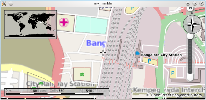
If things go fine, execute ./my_marble some-file.osm and you get a Marble Widget which displays your OSM file. For example, download and unpack Map.osm (a LinearRing representing Bangalore city junction), place it in the same folder as your my_marble.cpp file and run ./my_marble map.osm. The result should be similar to this:
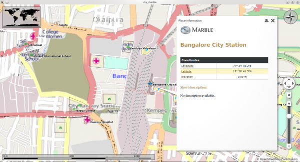
The placemarks on the map are clickable and trigger a dialog. The screenshot below is of the dialog of Bangalore City Station triggered by clicking it on the map.


