Marble/Routing/BasicRouting: Difference between revisions
Mayankmadan (talk | contribs) No edit summary |
No edit summary |
||
| Line 66: | Line 66: | ||
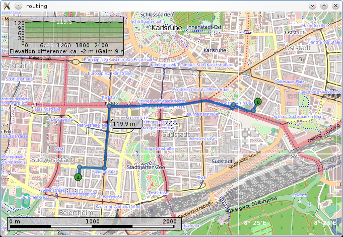
[[Image:Marble-basic-routing.png]] | [[Image:Marble-basic-routing.png]] | ||
The latest source code of this example can be found [https://quickgit.kde.org/?p=marble.git&a=blob&f=examples%2Fcpp%2Fbasic-routing%2Fmain.cpp here]. | |||
{{tip| | {{tip| | ||
Revision as of 20:09, 8 December 2015
| Tutorial Series | Marble C++ Tutorial |
| Previous | Tutorial 8 - OnlineServices |
| What's Next | Tutorial 10 - Searching |
| Further Reading | n/a |
Basic Routing
The Marble library 0.13 and later (KDE 4.8, Marble 1.3) has an API to calculate and manage routes. Let's start with a brief overview of the important classes and their interaction. The class RouteRequest holds parameters that are constraints for the route to be calculated: Start and destination, optional via points and further parameters (e.g. transport type). The RoutingManager passes such a request to backends (routing plugins) that calculate possible routes from it. The best route is chosen and displayed in a special layer in the MarbleWidget. Additionally you can access the route data via the RoutingModel. This model can be passed directly to e.g. a QListView to show the turn instructions, but also exposes further data like the waypoints of the route via the Route class. This one consists of a set of RouteSegment instances, each representing a number of waypoints and an optional turn instruction (Maneuver) at the end.
#include <QtGui/QApplication>
#include <marble/MarbleWidget.h>
#include <marble/MarbleModel.h>
#include <marble/RouteRequest.h>
#include <marble/RoutingManager.h>

using namespace Marble;

int main(int argc, char** argv)
{
    QApplication app(argc,argv);

    // Create a Marble QWidget without a parent
    MarbleWidget *mapWidget = new MarbleWidget();

    // Load the OpenStreetMap map
    mapWidget->setMapThemeId( "earth/openstreetmap/openstreetmap.dgml" );
    mapWidget->setProjection( Mercator );

    // Access the shared route request (start, destination and parameters)
    RoutingManager* manager = mapWidget->model()->routingManager();
    RouteRequest* request = manager->routeRequest();

    // Use default routing settings for cars
    request->setRoutingProfile( manager->defaultProfile( RoutingProfile::Motorcar ) );

    // Set start and destination
    request->append( GeoDataCoordinates( 8.38942, 48.99738, 0.0, GeoDataCoordinates::Degree ) );
    request->append( GeoDataCoordinates( 8.42002, 49.0058, 0.0, GeoDataCoordinates::Degree ) );

    // Calculate the route
    manager->retrieveRoute();

    // Center the map on the route start point and show it
    mapWidget->centerOn( request->at( 0 ) );
    mapWidget->setDistance( 0.75 );
    mapWidget->show();

    return app.exec();
}
Copy and paste the code above into a text editor. Then save it as my_marble.cpp and compile it by entering the following command on the command line:
g++ -I /usr/include/qt4/ -o my_marble my_marble.cpp -lmarblewidget -lQtGui -lQtCore
If things go fine, execute ./my_marble and you end up with a fully usable OpenStreetMap application:
The latest source code of this example can be found here.

- You need Qt and Marble development packages (or comparable git installations), version 1.3 (Marble library 0.13), shipped e.g. with KDE 4.8
- If Qt headers are not installed in /usr/include/qt4 on your system, change the path in the g++ call above accordingly.
- Likewise, add -I /path/to/marble/headers if they're not to be found in /usr/include


