Marble/MarbleUsedBy: Difference between revisions
Schmeisser (talk | contribs) added Screenshot for geoshape |
Earthwings (talk | contribs) Update description to the new screenshot |
||
| Line 28: | Line 28: | ||
==== Cockpit ==== | ==== Cockpit ==== | ||
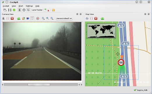
[[Image:Cockpit-with-marble.png|521px|thumb|Visualization of GPS and video data in the Cockpit application.]] | [[Image:Cockpit-with-marble.png|521px|thumb|Visualization of GPS and video data in the Cockpit application.]] | ||
<b>Description:</b> Cockpit is an application for the visualization of sensor data and assistance functions of cognitive systems. The screenshot shows the usage of Marble to visualize the | <b>Description:</b> Cockpit is an application for the visualization of sensor data and assistance functions of cognitive systems. The screenshot shows the usage of Marble to visualize the position of the vehicle (orange, GPS position mapped to the nearest road). The camera field of view shown in green in Marble corresponds to the video image on the left. Speed limit signs recognizedin the video are shown in Marble. Marble is also used to seek through sensor data (i.e. clicking on some point in the map seeks the video to the closest position).<br /> | ||
<b>E-Mail:</b> nienhues at fzi dot de | <b>E-Mail:</b> nienhues at fzi dot de | ||
Revision as of 21:02, 5 November 2009
Examples of applications that are making use of the Marble library
Distributions
Chakra-LiveCD
Screenshot
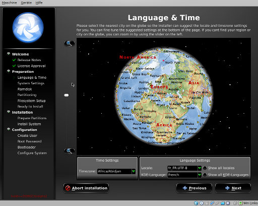
Description: Marble is integrated to configure Locale & Time inside the Installer of the Chakra Live-CD distribution.
Website: http://chakra-project.org
E-Mail: [email protected]
Applications
Mumoro
Screenshot: http://tristramg.eu/multimod.png
Description: Mumoro is a library to compute multimodal paths. The marble widget is used to display the route.
Website: http://github.com/Tristramg/mumoro
E-Mail: tristramg at gmail dot com
Cockpit

Description: Cockpit is an application for the visualization of sensor data and assistance functions of cognitive systems. The screenshot shows the usage of Marble to visualize the position of the vehicle (orange, GPS position mapped to the nearest road). The camera field of view shown in green in Marble corresponds to the video image on the left. Speed limit signs recognizedin the video are shown in Marble. Marble is also used to seek through sensor data (i.e. clicking on some point in the map seeks the video to the closest position).
E-Mail: nienhues at fzi dot de
Plugins
geoshape (Koffice2)

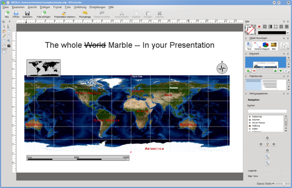
Description: geoshape is a so called shape, a plugin that can be used in (nearly) any Koffice2 application, like KWord, KPresenter and so on. At the moment it is limited to displaying a simple map, like they can be seen in Marble. Features like displaying adresses from a spreadsheet might follow later but are nowhere near implemented.
More information: geoshape project page

